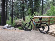
Mountain biking is the warm-season version of skiing and snowboarding in the Reno-Tahoe region. It’s an exhilarating downhill sport that fully immerses you in unblemished natural beauty, often in remote locations you can’t reach on foot. While not as grandiose as a visit to the ski slopes, mountain biking is a a better workout and opens up you up to a wider variety of terrains and locations — and doesn’t require as much setup and planning.
The Reno-Tahoe region is world-renowned for its mountain biking trails, several of which are easily accessible right outside of Reno proper. Here are five great trails close to Reno suitable for a wide range of skill levels.
1. Steamboat Ditch Trail
Mountain biking is an anaerobic activity, meaning that it constantly pushes you to your limits, and the hills around Reno tend to be rocky and steep. If you just want an easy day that doesn’t involve hauling your bike and body uphill for an hour before you get to ride back down, there’s the Steamboat Ditch Trail, a flat trail that winds along the southwest side of town.
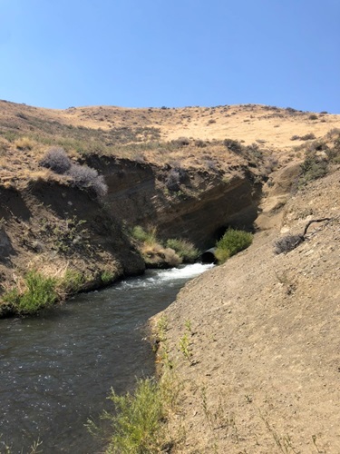
Steamboat Ditch Hole in the Wall
While this trail is extensive and can be accessed from multiple locations, one great starting point is the dirt parking lot on Woodchuck Circle. From there, you can head northwest for a fairly flat and even ride along the Steamboat Ditch canal. The canal (and path that runs alongside it) winds back and forth along the hillsides for a few miles, with occasional tree cover and lushness. After a while, you’ll find great views of the Truckee River below, as well as Verdi and Northwest Reno. As you continue onward, you’ll pass through the Tom Cooke hiking area before reaching the Hole in the Wall, which is the source of the canal’s water coming from mountain runoff and diverted water from the Truckee River far up the mountains.
This is an out-and-back trip, so you’ll have to turn around and go back the same way, but the entire trip can be done in a couple hours or so without too much huffing and puffing. It’s also notable that Steamboat Ditch continues to wind through the Caughlin Ranch neighborhoods, so there are many other starting points and places to see along this route.
2. Rancho San Rafael and Evans Canyon
Moving up a notch in terms of difficulty, Rancho San Rafael Park and the adjacent Evans Canyon have mixed-use trails that are mostly flat but have a few steep sections the further uphill you decide to go.
On a mountain bike, setting off from the Evans Canyon parking lot is ideal, as you will avoid heavy foot traffic that may be in other parts of the park. This way, you can pass the Basque Monument and head toward the Nature Trail, a favorite among school hikers, though wide enough to accommodate mountain bikers passing through.
After passing over the stream going northwest, you can continue north as far as you want up Evans Canyon along the creek toward, or if you prefer, you can head up the hillside on one of the trails towards the Nevada N and back around to the nature trail. Either way, there’s a lot to explore here in this mix of green creek areas and barren hillsides.
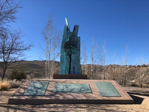
Basque Monument at Evans Canyon
3. Whites Creek & Thomas Creek
Not far outside of South Reno is the much-loved Whites Creek-Thomas Creek-Galena Creek hiking area. Sitting in the foothills of Mount Rose, this is where the climate and landscape have transitioned from high desert to low mountain ranges. Tall trees, streams, wildlife, fresh air and greenery call this space home.
The single tracks are open to mountain bikers, and while they are moderate in intensity at lower elevations, they quickly get narrow, steep and rocky as you head uphill into more interesting areas. Whites Creek to Dry Pond is an ideal trip, which can be done either as an out-and-back or a loop (adding a couple miles). It’s doable in a few hours, but it is very intense for the last uphill stretches, though you can always stay down at lower elevations along the creeks if that suits you instead.
Dry Pond is an open meadow (a dried-out pond) at the top of one of the lower mountain ranges in the Mount Rose Wilderness and is an excellent stopping point for lunch before you brave the other side of the mountain. The scenery here is just as nice as anything at Tahoe, though much closer to Reno. Be extra mindful and respectful of hikers and dogs in this area, as these trails can be narrow and crowded with foot traffic on the weekends.
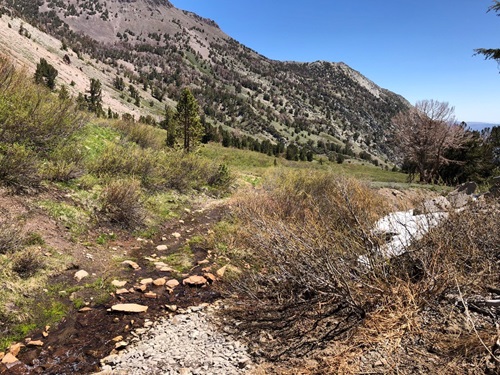
Meadow on Tamarack Lake Trail
4. Tamarack Peak Mount Rose
Getting into more technical terrain, the newly built Tamarack Lake Trail gives mountain bikers an opportunity to enjoy Mount Rose’s environs with a trail purpose-built for mountain bikers, which has been much needed since most of Mount Rose’s trails are off-limits to bikes.
Set off at Atoma Road just past Slide Mountain on the Mt. Rose highway. From here, you have an 8.8-mile ride ahead of you through high alpine terrain. Tree cover will become less frequent the higher up you ride and beautiful alpine meadows will open up.
Elevations in this area quickly approach the 10,000 foot mark, so be prepared to breathe in thin air and face a stronger sun than you are used to. Shoot to complete the whole trail if you can handle it, but at the very least make it to Tamarack Lake and back. Another option is to leave from the Mt. Rose summit parking lot and go downhill toward the lake, which is only about 1/3 the length of the total 9-mile trail.
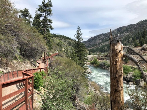
Wood Trail from Foriston to Truckee
5. Floriston to Truckee – Tahoe Pyramid Trail
If none of these trails is quite as long and intense as you would like, there’s always the Tahoe Pyramid trail that runs all the way from Tahoe to Truckee to Reno and is intended to go all the way to Pyramid Lake when complete. Currently, there are just under 60 miles of trail running from Lake Tahoe Dam to Vista Boulevard in Sparks.
With such a huge span of trail to choose from, and almost all of it with either delightful or epic scenery, it’s difficult to recommend any one section of it. Ideally, you would do sections at a time and complete the whole trail system. But one area that stands out is between Floriston and Truckee. You can park at the Floriston Exit just past the overpass and start on the path toward Truckee.
Not long after starting, you will find yourself on a narrow wood path that runs alongside and overhangs the Truckee Rapids at times. A little bit later, you’ll have to walk your bike up a set of stairs, but there is a thoughtful space to roll your wheels on the right.
Photo credits: Dan Bablinskas


 Dan Bablinskas is a relentlessly curious person with a passion for travel, foreign languages, affordable food and lodgings, well-fashioned cappuccinos and refreshing craft brews. After receiving his bachelor’s degree in creative writing, he traveled through Europe and South America while working as an English teacher and travel blogger. After trying a number of different careers, he settled into technical and content writing for his day job. In his spare time, he enjoys exploring the Reno-Tahoe area by foot, car, bike and ski. He lives in Reno with his wife and two kids.

